I have a newbie question...
I always used the International Standard Atmosphere model whenever I needed to calculate the temperature in a given altitude. It always looked accurate to me...
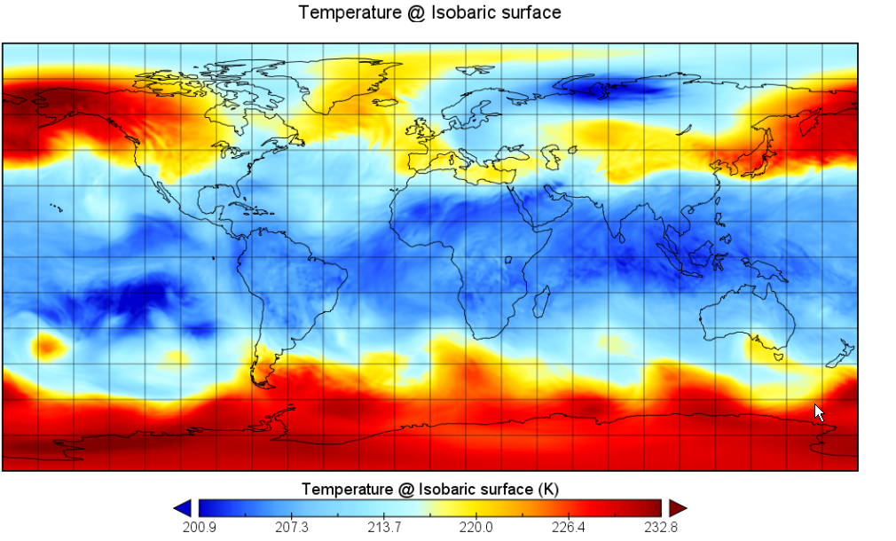
However, doing some work using GFS data, I found something intriguing..
At a given high altitude (let's say : 150 hpa/44000ft), the temperature I saw in the GFS model was almost always colder than the ISA temperature for that altitude
This was mostly TRUE for latitudes between -30 and 30º, and the OPPOSITE for abs(latitudes) > 30º.
Example:
So, I came with a hypothesis... Want I want to know if it is crazy or not.
- The ISA model is an average model. Temperatures in the tropics are lower (for high altitudes) and the temperatures near the poles are higher. The final average is the ISA model.
