There's a bunch of armed conflicts going on right now. What are the lower boundaries on accuracy of triangulating and timing man-made events from the IRIS datasets (accessible, for instance, with the ObsPy package)?
2 Answers
David Salzberg and Margret Marshall suggest that using green receiver functions (which might make more sense given how we determine the difference between explosions and earthquakes) can locate a detonation in North Korea with up to 0.5 km accuracy. I am assuming that IRIS data sets carry enough information to make receiver functions, as I think triangulation may require a much larger event than a single nuclear warhead (not sure about this point) to be very accurate.
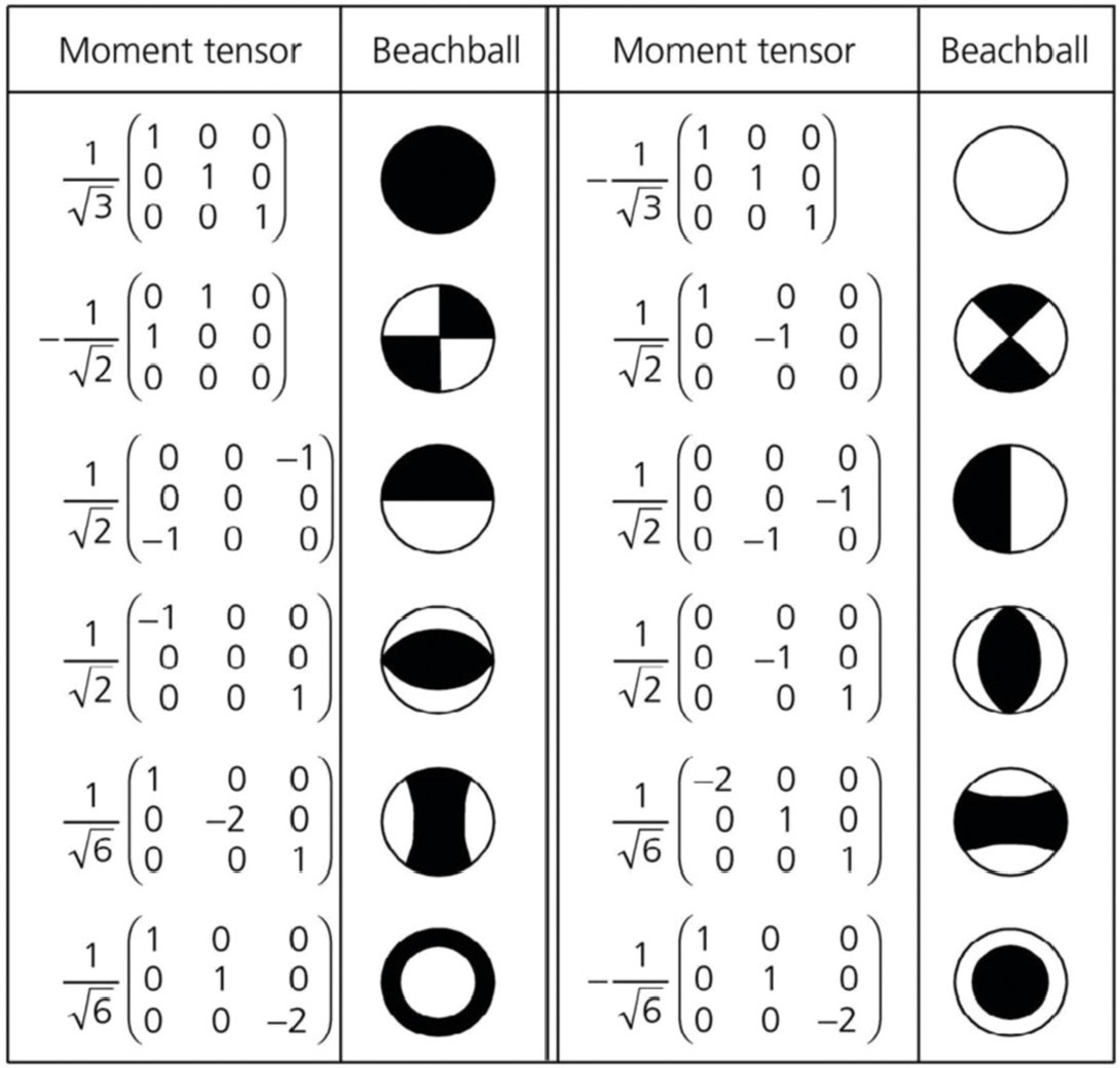
For a little background on how we determine if an event is a explosion or an earthquake (I know this isn't part of the question, but still useful for others) we look at "beachball" diagrams(from csegrecorder.com):

As you can see, the "beachball" diagrams are visual representations of the three linearly independent stress vectors or moment tensors. I may be getting these colors reversed (so someone check on it) but "white" means dilation and "black" means compression. A fault rupture will have some compression and some dilation, meaning some "white" and some "black", but an explosion will appear to be fully compressed because an explosion pushes on every direction. Think about a slinky: when you push on it, there is compression, and when you pull on it dilates. So an Implosion, that pulls everything towards one point, would be extensional, and thus be fully "white".
-
1$\begingroup$ I wonder if it would be better to make a question out of the second part of what you've written and answer it there? $\endgroup$ Commented Oct 8, 2014 at 11:43
Bayesloc, according to the keywords nuclear explosion monitoring in its URL https://www-gs.llnl.gov/nuclear-threat-reduction/nuclear-explosion-monitoring/bayesloc, seems exactly the software you can use to get an estimation of the uncertainties in the location of the event.
You can find a review of available software in this article:
KARASÖZEN, Ezgi and KARASÖZEN, Bülent. Earthquake location methods. GEM - International Journal on Geomathematics. December 2020. Vol. 11, no. 1, p. 13.