9
$\begingroup$

Currently central and northern Europe are experiencing a very cold, false-spring like weather phenomenon.

When i look at local weather charts, the daily temperature cycle seems to be completely gone, and replaced by a constant -8°C to -10°C, see below for an example of southern Sweden.

enter image description here

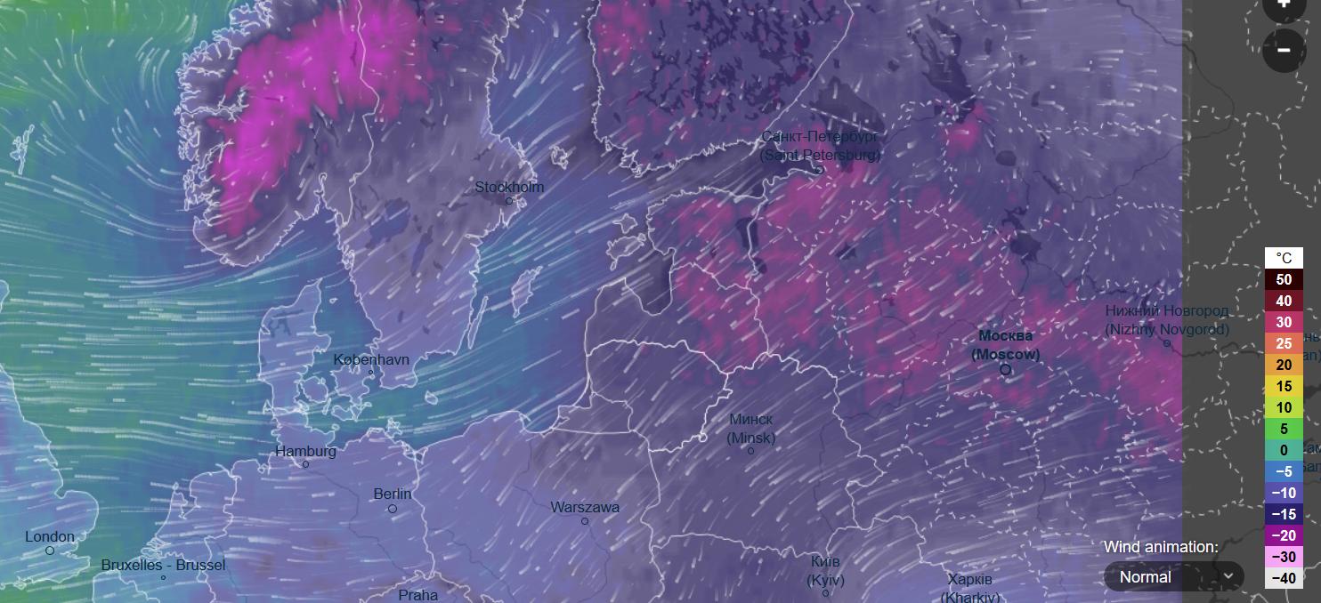
Taking a look at ventusky.com we also see that the cold air is being advected from colder regions in Europe to southern Sweden, as seen in this screencap:

enter image description here

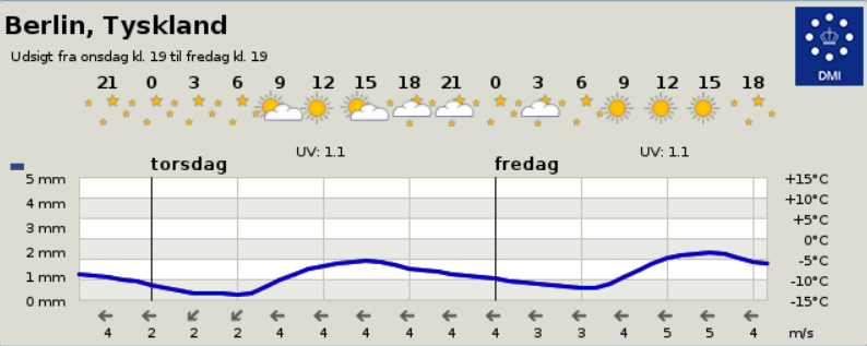
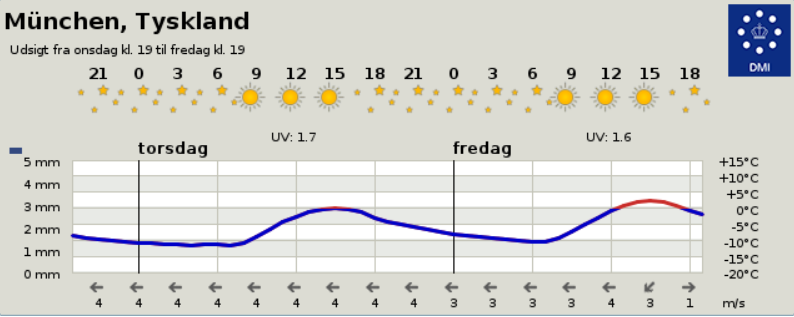
Other locations don't display this behaviour any more: The farther south I look, i.e. Berlin and Munich, the stronger the daily fluctuations get again, see both for comparison:

enter image description here

enter image description here

This 'constant temperature' seems odd enough for me to ask the question:

Is the constant temperature here in southern Sweden for a few days a lucky coincidence of temperature advection sources, or is this a known phenomenon and there is some interesting physics behind this?

$\endgroup$
3
  • 1
    $\begingroup$ This flattening of the daily temperature cycle is also a characteristic feature of winter weather in Siberian midlatitudes (50N-60N). Not sure if the reasons are exactly the same. $\endgroup$ Commented Mar 1, 2018 at 2:31
  • $\begingroup$ @DmitriChubarov: Interesting. Could this be the way to an answer? $\endgroup$ Commented Mar 2, 2018 at 9:39
  • $\begingroup$ @AtmosphericPrisonEscape You are going through a SSW - youtube.com/watch?v=Y1sw5qLpuSU $\endgroup$
    – user1066
    Commented Mar 11, 2018 at 12:02

1 Answer 1

4
$\begingroup$

There are (at least) five factors at play here:

  1. the cold air advection from the north east has driven temperatures down
  2. the cloud cover traps longwave radiation sort of like a blanket, keeping the night time temperatures from dropping
  3. also, the cloud cover prevents solar radiation from reaching the surface and warming it
  4. the relative humidity is near 100%, indicating that the dew point is nearly the same as the air temperature. Dew point serves as a minimum possible temperature, so this also prevents the air temperature from dropping
  5. precipitation traveling through the lower atmosphere will evaporate, having two effects: cooling the atmosphere and maintaining a high dew point

(5) is only really a factor during the day when temperatures would normally be on the rise. The precipitation will keep the diurnal heating to a minimum.

$\endgroup$
6
  • $\begingroup$ Points 2. and 3. could of course always be true. Intuitively 4. makes the most sense, but this would also imply selective advection of moisture at night to keep temperature from dropping. Are there any assessments of the relative importance of those effects (for any situation)? $\endgroup$ Commented Mar 3, 2018 at 11:08
  • $\begingroup$ I've updated my answer to show how the precipitation both cools and moistens the atmosphere during the day. Note that cooling by evaporation is only capable of reducing the temperature to the dew point. $\endgroup$
    – DavidH
    Commented Mar 6, 2018 at 13:03
  • $\begingroup$ I repeat myself. Is there an estimation of which one of those effects dominates? Listing more and more reasons doesn't help to write a clear answer. $\endgroup$ Commented Mar 6, 2018 at 17:57
  • $\begingroup$ I am not aware of any assessments myself. Perhaps that is worthy of another question. $\endgroup$
    – DavidH
    Commented Mar 6, 2018 at 18:09
  • $\begingroup$ The additional factor was meant to address your 'selective advection' comment by showing that there are other sources of water vapor besides advection. $\endgroup$
    – DavidH
    Commented Mar 6, 2018 at 18:17

Your Answer

By clicking “Post Your Answer”, you agree to our terms of service and acknowledge you have read our privacy policy.

Not the answer you're looking for? Browse other questions tagged or ask your own question.