3
$\begingroup$

I grew curious after watching a presentation about the large creatures of prehistoric times. One of the theories cited about why creatures were so big was the increased oxygen in the atmosphere due to there being no ice caps which meant more available surface area for O2 emitting plant life and the large amount of available landmass for creatures to roam freely. This felt like what could be be historical hand-waving so I'm here looking for facts.

Modern climatologists scientists argue that rising temperatures and melting ice caps risk submerging land masses from the displacement of frozen ice. This is based upon the fact that the volume of water is greater than that of ice.

I did some googling around and saw that most prehistoric representations of Earth and renditions of Pangaea try to squish the shape of our existing continents together but do not address the increase in ocean volume, I assume for illustrative purposes or other simplification. I'm not arguing whether the continents fit together as depicted but rather how much of it existed above the surface of the ocean.

I know that the movements of tectonic plates can also affect what parts of land are underwater by coastal regions shifting lower and those inland shifting higher with the formation of mountains. Water erosion would also play a factor somewhere in all of this in addition to tectonics but only to a point of equilibrium with sea level.

It's interesting to consider that we have found and continue to find historical locations which have since become completely submerged. So it may be safe to assume that the oceans have been already been rising naturally for hundreds of years prior to the industrial revolution through other environmental factors.

Is there a definitive source of study on the subject of the percentage of landmass above sea level across history with relation to ambient temperature and the presence of ice caps?

I'm just a hobbyist who enjoys science and history and have no relevant expertise in this area nit this little idea has had be tickled with anticipation all morning. I would love to learn out more. :)
$\endgroup$
2
  • $\begingroup$ "The volume of water is greater than that of ice" is just plain wrong. Ice is less dense than water, so the volume of meltwater is less than that of the original ice. Melting ice causes sea level to rise because the ice is above sea level. $\endgroup$
    – Spencer
    Commented Aug 29, 2018 at 10:57
  • $\begingroup$ Another parameter to consider is isostasy: as the ice melts from a landmass, the landmass rises due to the release of pressure. This is known for example in Scandinavia, where harbours built by the Vikings are now, 1000 years later, above sea level. $\endgroup$ Commented Nov 7, 2019 at 17:20

1 Answer 1

1
$\begingroup$

The real cause rising temperatures is not frozen ocean turning back into water but the volume of the ocean itself expanding (water expands just like everything else when you heat it), and ice on land melting and flowing into the ocean (adding more water).

Ice sheets can be tricky to predict but it has been included in this report . Although for the most part ic just say whether it exists or not reconstructing total volume of ice is currently not something we can determine accurately.

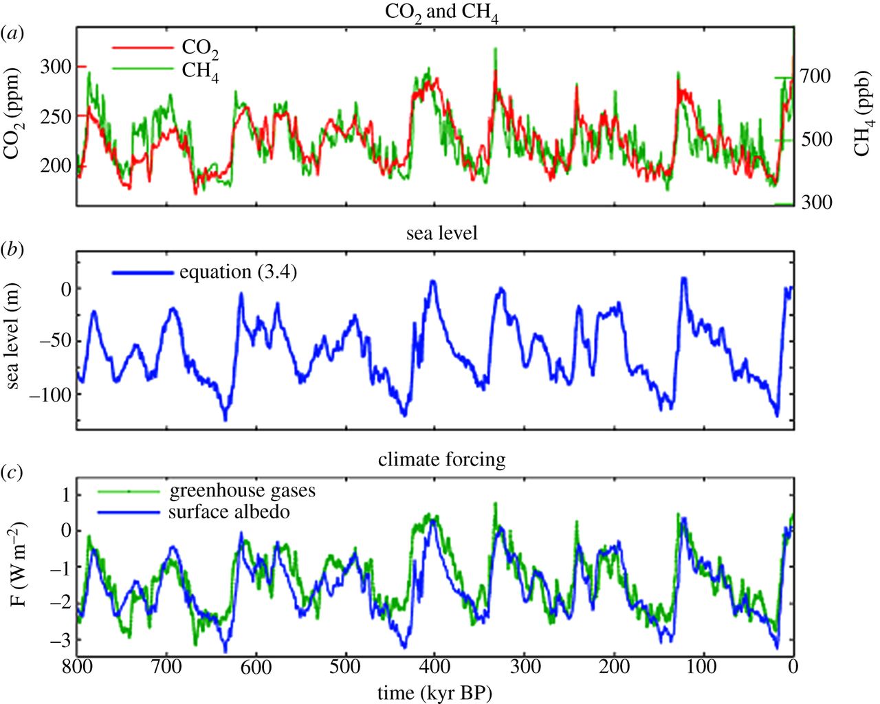
This chart from that report show how ocean temperature and sea level correlate. enter image description here

This paper shows how the two factors compare, they are are mostly comparable but ice melt (mostly glacier) is starting to overtake expansion. Great chart on page 1157.

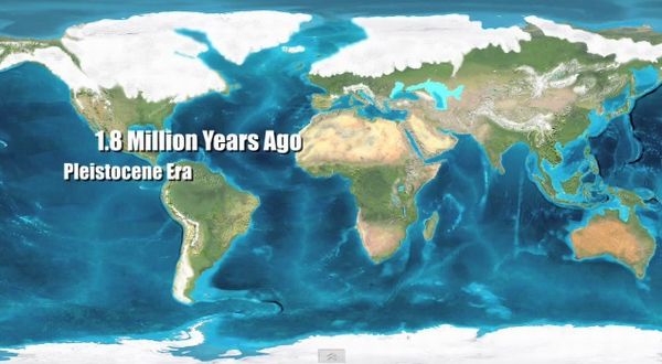
As for historical rise, earth used to have two ice sheets, one at each pole (this was responsible for the Asia-North America land bridge), but the northern one has almost completely melted, except for greenland, that is why we had historical sea level rise. There used to be thousands of feet of ice over boston. Land locked ice sheets are very sensitive to temprature, easy to melt, island ones like greenland and antarctica on the other hand create their own sort of insulation by altering circulation. These latter ones are much harder to melt, you need a much greater rise in temprature, which we have created. The last big melt turned england into an island.

enter image description here

$\endgroup$
2
  • $\begingroup$ "Land locked ice sheets are very sensitive to temprature, easy to melt, island ones like greenland and antarctica on the other hand create their own sort of insulation by altering circulation. These latter ones are much harder to melt". I have never heard this theory. I thought Greenland and Antarctica did not melt because they are closest to the poles $\endgroup$ Commented Aug 2, 2018 at 4:52
  • $\begingroup$ that is of course a factor as well, but greenland is much farther south than the current mainland ice sheets, isolating currents create a somewhat self contained local climate, $\endgroup$
    – John
    Commented Aug 2, 2018 at 15:17

Your Answer

By clicking “Post Your Answer”, you agree to our terms of service and acknowledge you have read our privacy policy.

Not the answer you're looking for? Browse other questions tagged or ask your own question.