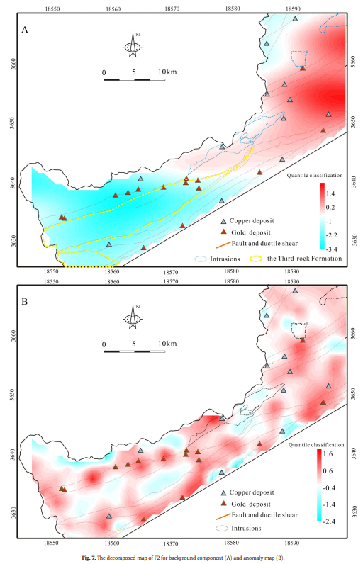
We know that geochemical dispersion in stream sediment is much widespread, facilitating discovering mineral targets in a regional scale. However, we also know that there should be discrepancy in space between the geochemical anomalies in stream sediement and buried mineralization.
I found there are a lot of published studies that used identified geochemical anomalies in stream sediment for mapping unknown mineralization directly, or as an evidence for mapping mineral prospectivity together with other geologic feature layers. They usually interpolated first the mineralization-related element concentrations with support of GIS, and used some algorithms for extract geochemical anomalies from the background. See, for example, this paper.
The authors delineate the mineral targets based on the anomaly map (figure b).
I am confused about why the geochemical anomalies in stream sediment can be used directly without considering the spatial discrepancy.
The figures are from this paper: https://doi.org/10.1016/j.gexplo.2015.06.018.
