We know that 67.3% of land mass is in the northern hemisphere, and 32.7% in the southern. Now we go towards the north from the equator. On which parallel the amount of landmass north of it and south of it is equal?
1 Answer
Roughly half the land on Earth is north of the Tropic of Cancer (23°N).
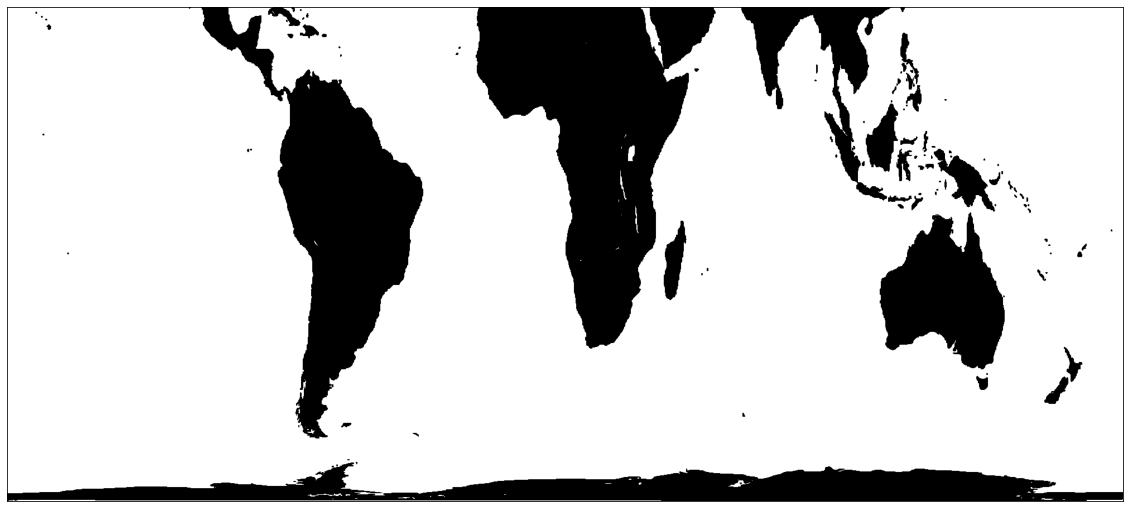
To estimate this, I just modified the code used by @MyCarta in their answer to "In the northern hemisphere only, what percentage of the surface is land?". Using a Peters equal projection map of the world from Wikipedia, I counted the total land pixels and then found the row in the map array which divided them in half. I then converted pixel row in the map array to a latitude using the inverse of the Peters y projection formula. Here are maps showing the northern and southern halves of the Earth's land.
Here is my (quick and inelegant) code:
import numpy as np
from skimage import io
from matplotlib import pyplot as plt

# Load equal area projection map from wikipedia
url='https://upload.wikimedia.org/wikipedia/commons/e/e2/Peters_projection%2C_black.png'
total_equal_area =io.imread(url, as_gray=True)

equal_area=total_equal_area

# Get shape and size of map
rows, columns = np.shape(equal_area)
total_area = rows*columns
print("Rows and columns in map: ", rows, columns)

ocean_area  = np.sum(equal_area)
land_area = total_area - ocean_area

print("Total pixels in map: ", total_area,
      ";   Land pixels in map:  ", int(land_area),
      "\nFraction of pixels representing land:",
      np.round(land_area/total_area*100, decimals=2))

n=386
equal_area_n=total_equal_area[:n, :]

r_n, c_n = np.shape(equal_area_n)
total_area_n = r_n*c_n
print("Cutoff row: ", r_n, ";  Total land pixels above this row: ",total_area_n)

ocean_area_n  = np.sum(equal_area_n)
land_area_n   = total_area_n - ocean_area_n

# Convert rows to latitude using Pinvers of Peters y formula from
#   https://en.wikipedia.org/wiki/Gall%E2%80%93Peters_projection#Formula
latitude_n = np.degrees(np.arcsin(1-2*n/rows))

print(np.round(total_area_n/total_area*100, decimals=1),
      "% of the Earth's total surface area and ",
      np.round(land_area_n/land_area*100, decimals=1),
      "% of the Earth's land area is North of Latitude: ",
      np.round(latitude_n, decimals=1),"°N", sep='')

# Plot map of area containing 50% of Earth's land
fig = plt.figure(figsize=(20,10))
ax  = fig.add_subplot(1,1,1)
ax.set_xticks([])
ax.set_yticks([])
plt.imshow(equal_area_n,cmap='gray')
-
$\begingroup$ Wow, thank you!:) What's funny is I've intuitively felt like the northern tropic actually divides land on map by half, not the equator, the equator for some reason always felt "so southern", it seemed weird but finally I figured all out :D $\endgroup$ Commented Aug 5, 2023 at 9:51

