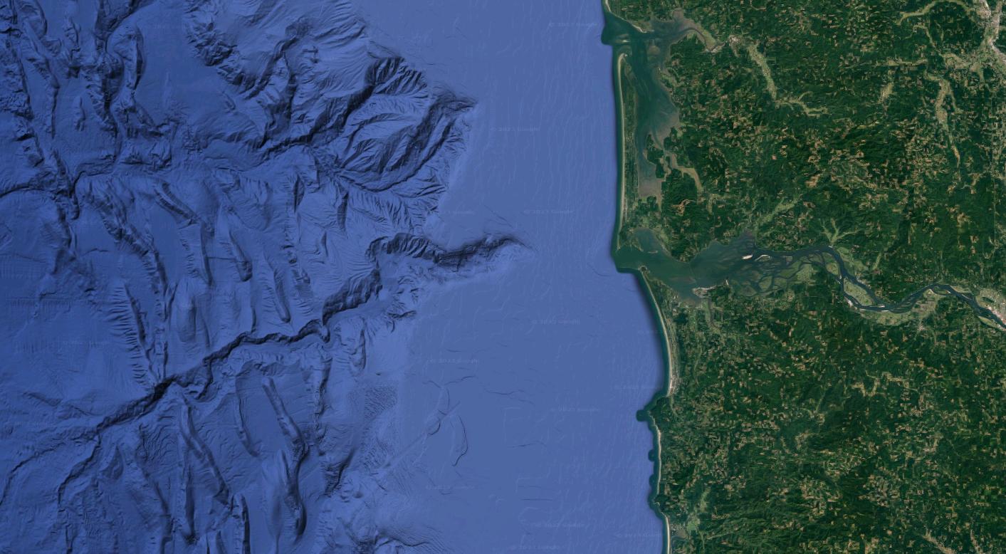
In this satellite pic, on the land is the Columbia river on the western side of North America.
I was amazed to see the channel within the sea, more than 125 km long.
Can it be concluded, based on this picture alone, that the channel was formed when the entirety of it was above sea level? In other words, is that the most plausible known mechanism for the formation of such sub-sea channels?
Can it also be concluded that the left end of the channel, where it divides into three streams, was the delta with the coast further to the left?
What is the reason for the sub-sea channel starting tens of km away from the coast? In the past, would the channel have extended right till the current mouth of the river, and then got filled up by sediments in later millennia?
