The Guardian article Scientists discover 91 volcanoes below Antarctic ice sheet highlights a recently published University of Edinburgh School of Geosciences discovery and cataloging of over ninety new volcanos under the Antarctic ice sheet. A new volcanic province: an inventory of subglacial volcanoes in West Antarctica by Maximillian van Wyk de Vries, Robert G. Bingham and Andrew S. Hein, Geological Society, London, Special Publications, 461, 29 May 2017, https://doi.org/10.1144/SP461.7 note: the article is Open Access!
edit: ...by clicking through the Lyell collection to here: http://sp.lyellcollection.org/content/early/2017/05/26/SP461.7 and then again to view the PDF http://sp.lyellcollection.org/content/early/2017/05/26/SP461.7.full-text.pdf
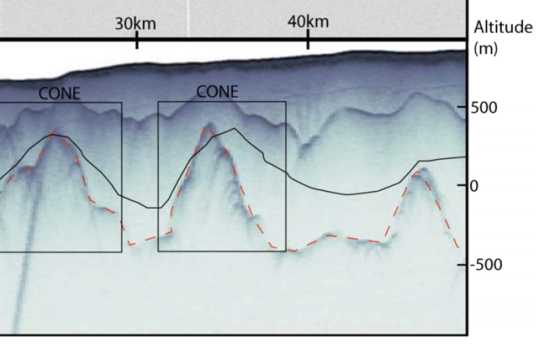
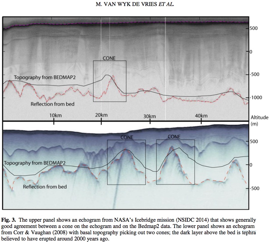
Below is a screenshot of figure 3, including a cropped subsection. If you open the figure in a new window you can view it at full size. In the subsection there are two rectangles with the word CONE above them. Below these words there are two traces. If I understand correctly, the lower trace is (for lack of better vocabulary) the surface of the Earth, and those cones have been identified as volcanos. However I believe the upper trace is the top of a layer of tephra:.
Tephra is fragmental material produced by a volcanic eruption regardless of composition, fragment size or emplacement mechanism.1
Volcanologists also refer to airborne fragments as pyroclasts. Once clasts have fallen to the ground they remain as tephra unless hot enough to fuse together into pyroclastic rock or tuff.
I'm trying to understand what might have happened here. the two cones are of the order of 10 km apart, and they extend above and below sea level. Was there an eruption below the ice which acted as a buffer and contained the ejecta? With some melting, some water below the ice could help it to flow over time and redistribute more evenly between the cones. Or would these volcanos just blow the ice away completely for an extended period of time and Southern Ocean currents could assist in the redistribution?
Fig. 3. (repeated here in case the original is not easily legible on your device) The upper panel shows an echogram from NASA’s Icebridge mission (NSIDC 2014) that shows generally good agreement between a cone on the echogram and on the Bedmap2 data. The lower panel shows an echogram from Corr & Vaughan (2008) with basal topography picking out two cones; the dark layer above the bed is tephra believed to have erupted around 2000 years ago.

