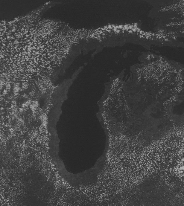
There are a couple reasons for this. First, Lake Michigan is still cold this time of year, relative to the land that surrounds it. Warm air flowing over the lake will exchange heat and cool, reducing its buoyancy, which will alter the heights at which clouds will form and inhibit lift for surface parcels to achieve that height.
That helps explain the cloudlessness over the lake, but this extends a bit inland as well. I'd have to do a little digging to verify this, but just from that image it looks like that demarcation of cloud/no cloud around the lake is a sea breeze front (or in this case, a lake breeze). The daytime lake breeze flows inland from the water, rises over land and then flows back to the lake where it descends. This will promote clouds where the circulation rises and inhibit them where the circulation falls.
There may also be an orographic effect on along the northern portion of western MI shore, as there are large sand dunes and hills in that area. The upslope flow could be the reason the clouds hug that shore a bit closer than other regions around the lake.
In summary, that looks like a really well defined lake breeze circulation, which explains the shape and location of the clouds.
