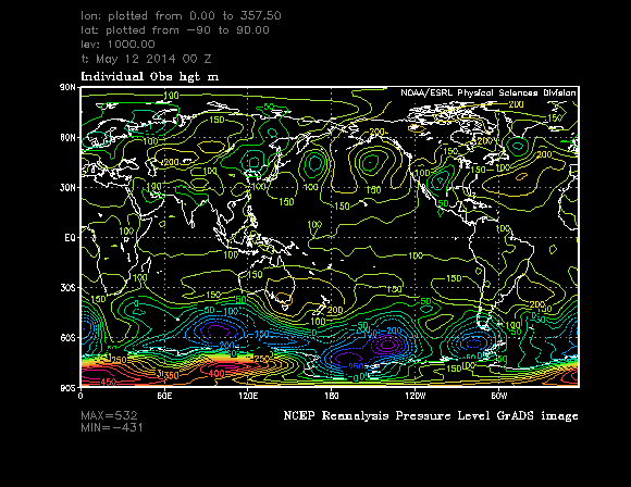
I am using NCEP Reanalysis Geopotential height data and this is at 1000 mb and downloading it from here - 1000 Mb Geopotential height values and some of these values are negative for a particular date - May 12th 2014 00Z. I am aware of geopotential height anomalies - Geopotential height anomalies and that these can be negative i.e. the average of a height surface is lower than than what it should be. But the negative values I am referring to are "raw" geopotential height values and not anomalies.
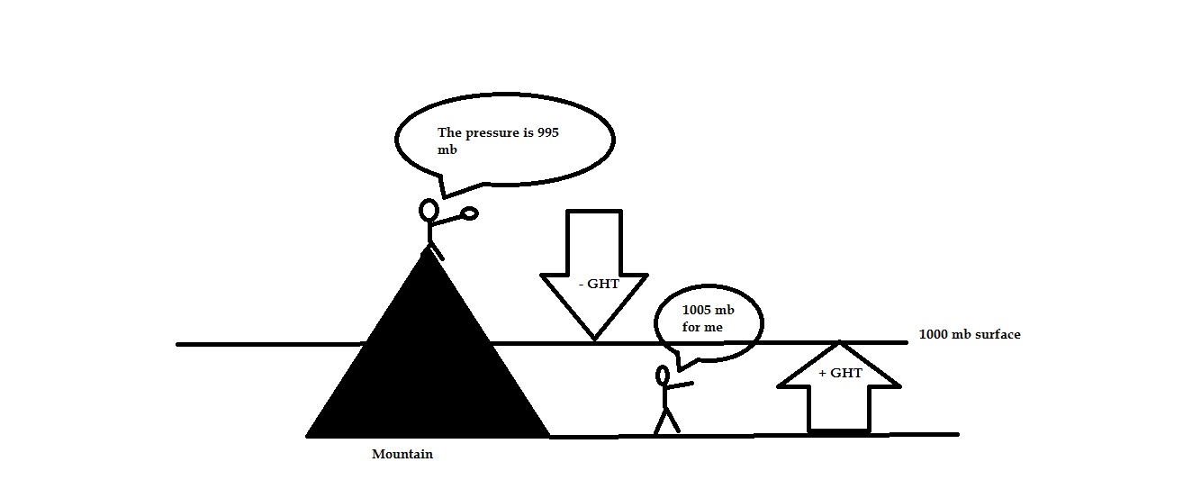
When I sent them a note and asked them what that meant this is the explanation I got - "1000mb geopotential height could be negative if the contour line drawn around the surface of the earth connecting all 1000mb pressure intersected with the earth's surface. At the point where the height was negative, the 1000mb height is actually below the ground and pressure is low."
Can someone explain what that means as doing a google on negative geopotential does not reveal anything meaningful ?

