Was discussing the terrain and rivers of Europe today with my father and it became apparent that a graph of the elevation versus course of a river would offer interesting insight, including a quick summary into the elevation of various cities of interest along the course, and some loose feel for the possible speed of the river in various spots.
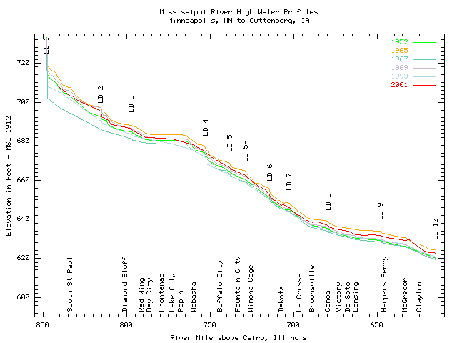
I did find one image fitting the general theme of what I was looking for regarding the upper Mississippi River at an Army Corp of Engineer's website:
But I didn't have any subsequent luck in Googling the terms used there, nor on any additional terms, for rivers like the Rhine and Danube.
Are these along-course cross-sections made enough that there's a name for them?
And if so, is there any resource where such images can readily be found for major rivers worldwide?


