2
$\begingroup$

I am looking for videos/image series that show (at least a section of) the (daytime) sky at a given location for a prolonged time (ideally > 1 year).

This youtube video is one example of what it could look like - a time lapse of an entire year, where a photo at the same spot was taken every day at the same time. I was wondering if there is a (scientific) resource (perhaps in the meteorology/astronomy community) that would give access to better images/videos and for more locations around the world. It could also stem from wildlife cameras or the recording of public webcams; are there repositories for such data?
$\endgroup$

1 Answer 1

5
$\begingroup$

It may be more than you want, and more terrain-focused, but UC San Diego's High Performance Wireless Research and Education Network (HPWREN) has an archive for each of dozens of fixed-angle Southern California wilderness cameras at http://hpwren.ucsd.edu/cameras/. (I say "more than you want" because the cameras take images every minute, so finding just one image per day will take a little digging.)

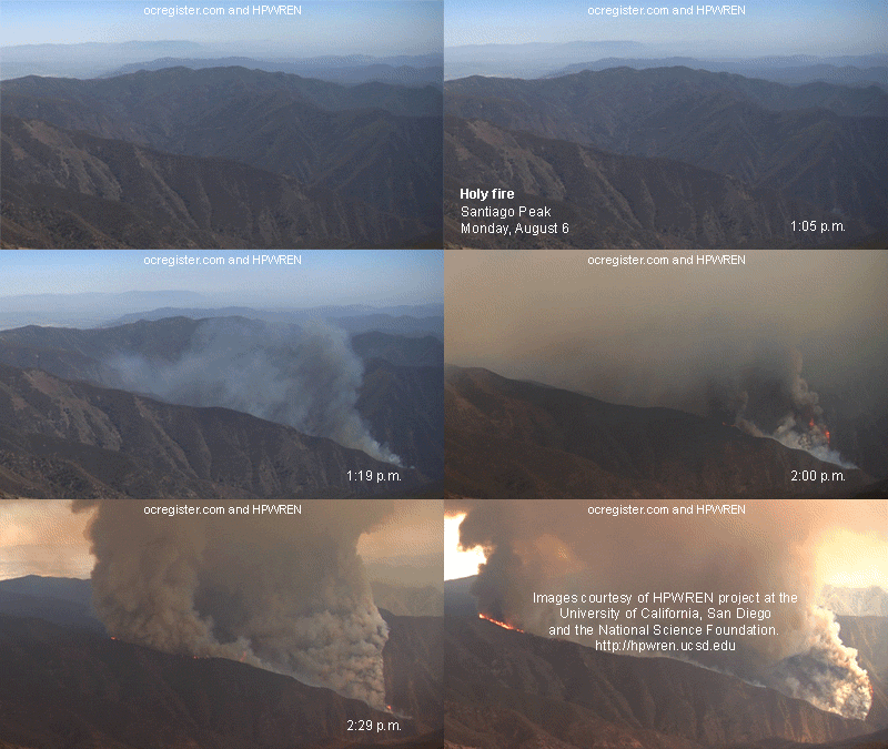
The cameras have been adapted for use detecting and monitoring wildfires, so that's what they've become best known for. Here's a sample animation:

Animated GIF of a fire breaking out

The archives may be a little hard to find since clicking on the thumbnails will usually open a larger version of the same image, but there should be a link to each site. Once on http://hpwren.ucsd.edu/cameras/RedM.html, for example, there's a "data" link for each camera that opens into the actual folder structure of the repository.

Please note the usage conditions.

There is also a YouTube channel featuring past animations, mostly of fires.

$\endgroup$
2
  • $\begingroup$ Thanks, that's exactly the thing I'm looking for; just that I am looking to cover as many places around the world as possible. Might there be a database that lists individual projects such as this in one place? $\endgroup$
    – Anonymous
    Commented Aug 20, 2021 at 8:51
  • $\begingroup$ @Anonymous I'm afraid I don't know of any database like that, but if you search for "wildland cameras" and "fire detection camera networks" you'll find similar systems. The HPWREN camera system grew out of an operational need to support the high-bandwidth wireless network; and the network is what enables the camera system to pump out so many images from remote areas. I suspect a lot of contemporary equivalents just use streaming video. The US Geological Survey has a number of similar webcams via apps.usgs.gov/sstl, but they don't appear to have the same sort of archiving. $\endgroup$ Commented Aug 20, 2021 at 14:57

Your Answer

By clicking “Post Your Answer”, you agree to our terms of service and acknowledge you have read our privacy policy.

Not the answer you're looking for? Browse other questions tagged or ask your own question.