The main resistance that winds have to their movements comes from the topography and surface obstacles. Therefore, as a general rule the closer to the surface the less wind you will find. But I guess you are interested in the winds in areas clear of surface obstacles, otherwise the answer would a be a cave or a dense forest somewhere.
To figure out what is the calmest place on Earth wind-wise, we can use one of the global datasets that NASA put together (initially to help with solar and wind energy planning). One of them is a 10-year average (July 1983 - June 1993) of wind speed at 50 m above surface, ignoring the effect of trees and other non-topographic obstacles at a resolution of one degree (roughly 111 km or less).
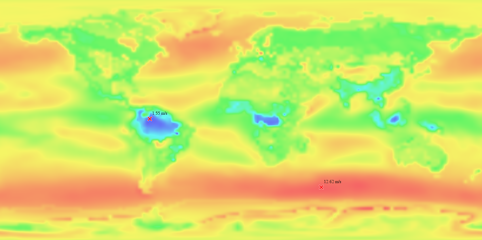
I just loaded that dataset and searched for the minimum (and maximum) values, this is how it looks:

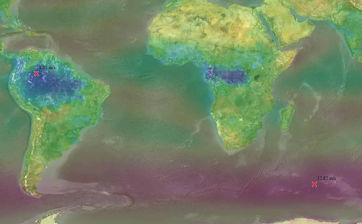
The minimum is not actually in Antarctica as your research suggested, but in the Amazon at longitude 68° west and latitude 0° (that's Brazil near the border with Colombia), with a mean wind speed of 1.55 m/s (5.6 km/h).
This is an enlarged version of the most relevant area overlaid with a world map for easier interpretation:

In line to what was stated at the beginning, the maximum happens in an area were the lack of landmasses allow it to blow unimpeded around the world. And it happens at 60° W -52° S, reaching a mean wind speed of 12.62 m/s (45 km/h).
Note that this analysis is valid for broad areas. And of course individual weather stations at punctual locations can give different values. As for Antarctica, the winds there are mainly catabatic, therefore at the top of antarctic domes the average wind speed are very low. For example the average at Dome C is 10.1 km/h and 9.4 km/h at Dome F. However, those values are still bigger than what NASA's models suggest for the Amazonas.
I think the model I used here is reliable. As an exercise, you can see all the images that show up in a Google search for "global mean wind speed" and you see that most images show a similar pattern, where Antarctica doesn't seem to contain the calmest place.
The model used to produce these datasets is a reanalysis, it means it takes all the weather data of the past (weather stations and satellite data) and attempts to reconstruct how exactly was the weather over the whole word. A similar kind of model takes only past weather data and attempts to predict how will be the weather over the whole world. That's a much more difficult problem, prone to bigger errors but that's actually what all the weather forecast we see on TV are based upon. One of the best global forecast models is called GFS (Global Forecast System) that is produced by NOAA's Environmental Modeling Center.
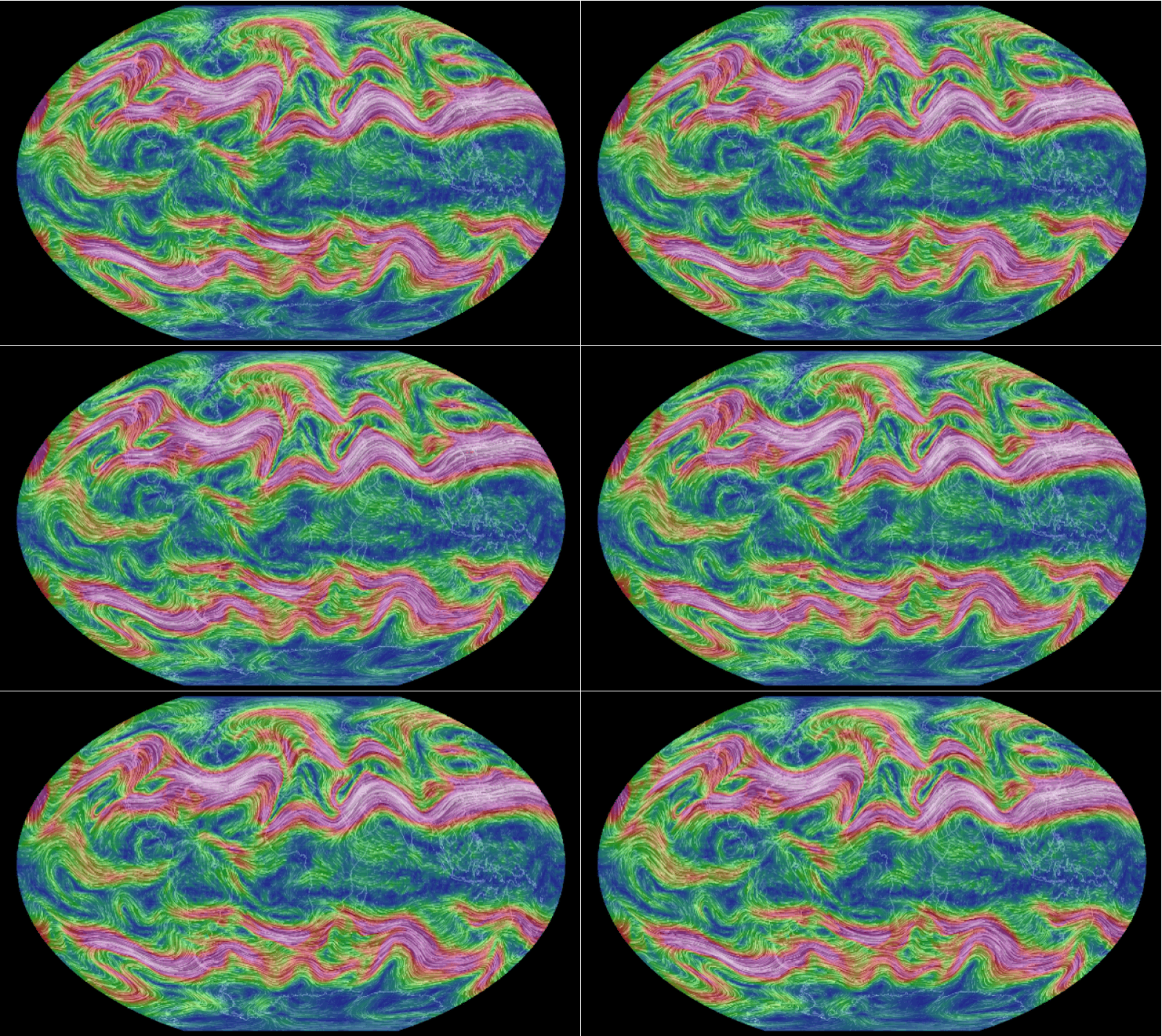
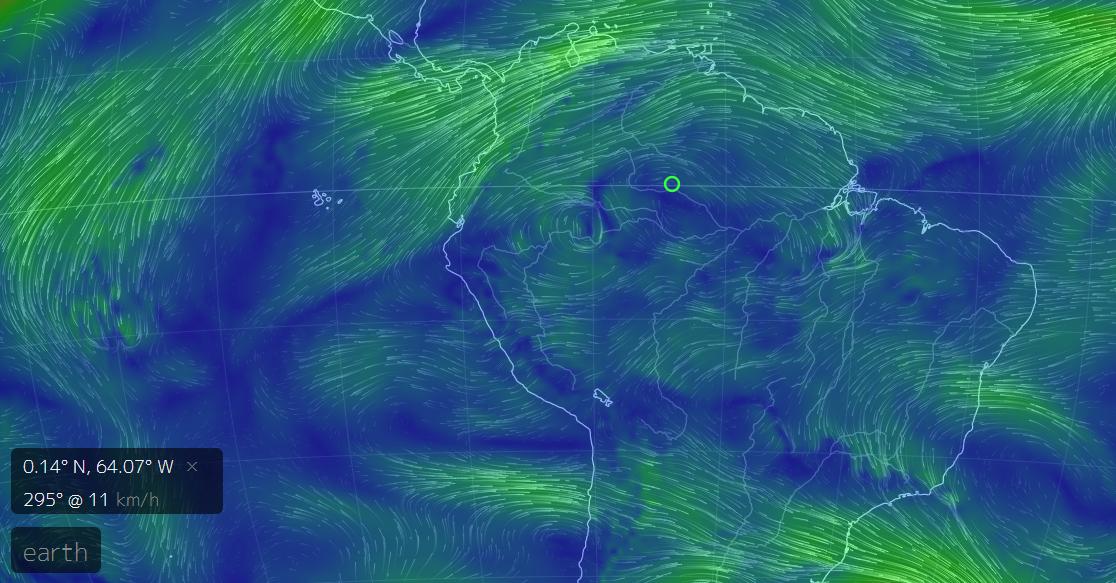
To have a sense of how winds vary in different locations and altitudes you can explore the GFS data using Cameron Beccario's amazing vizualization tool. There you can see the predicted global wind patterns all the way from the surface to more than 26 km of altitude (here you can find a table with referential equivalences between pressure levels in hPa and altitudes). Despite those are not multi-year averages, they are still very informative. Muze, the author of the question, pieced together a beautiful animated gif that show how the above mentioned visualization looks like for the elevation range of the jet streams at about 10 km of altitude (250 hPa):


Finally, I have to note that I've interpreted "calmest" as the minimum mean wind speed. However, it would be sensible also to consider it as the place with the lowest maximum wind speed or some other metric, that would perhaps change the picture described above. And maybe using that metric one of the Antarctic domes could be the "calmest" place. But I won't extend the answer further with any possible interpretation for "calmest".


